File:Oga Peninsula and Hachirogata Akita Japan SRTM.jpg

Size of this preview: 608 × 600 pixels. Other resolutions: 243 × 240 pixels | 486 × 480 pixels | 681 × 672 pixels.
Original file (681 × 672 pixels, file size: 103 KB, MIME type: image/jpeg)
Summary
| Description |
Deutsch: Satellitenbild der Oga-Halbinsel, Japan
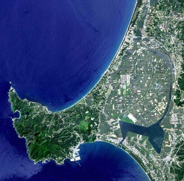
English: Satellite image of Oga Peninsula, Akita, Japan. Hachirōgata is the flat farmland surrounded by water near the base of the peninsula.
日本語: 日本・秋田県にある男鹿半島の衛星写真。八郎潟は半島の付け根付近にある、水に囲まれた平坦な農地。 |
| Date | |
| Source | image with high-resolution data from Space Shuttle. |
| Author | user:っ |
| Other versions |
|

Licensing
This image uses high-resolution digital topography data from NASA's Shuttle Radar Topography Mission (SRTM) at JPL-Caltech [1]. It is in the public domain in the United States.
|
 | |
File history
Click on a date/time to view the file as it appeared at that time.
| Date/Time | Thumbnail | Dimensions | User | Comment | |
|---|---|---|---|---|---|
| current | 05:50, 12 January 2005 | | 681 × 672 (103 KB) | wikimediacommons>っ | Oga Peninsula, Akita, Japan. Landsat image with high-resolution data from Space Shuttle. {{GFDL-Landsat-Kashmir3d}} {{SpaceShuttle}} |
File usage
No pages on the English Wikipedia link to this file. (Pages on other projects are not counted.)